Spatial Analysis and Satellite Imagery in a GIS
$49
ENROLL NOWCourse Overview
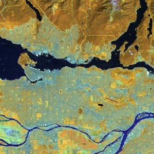
In this course, you will learn how to analyze map data using different data types and methods to answer geographic questions. First, you will learn how to filter a data set using different types of queries to find just the data you need to answer a particular question. Then, we will discuss simple yet powerful analysis methods that use vector data to find spatial relationships within and between data sets. In this section, you will also learn about how to use ModelBuilder, a simple but powerful tool for building analysis flowcharts that can then also be run as models. You will then learn how to find, understand, and use remotely sensed data such as satellite imagery, as a rich source of GIS data. You will then learn how to analyze raster data. Finally, you will complete your own project where you get to try out the new skills and tools you have learned about in this course. Note: software is not provided for this course.
Course FAQs
What are the prerequisites for 'Spatial Analysis and Satellite Imagery in a GIS'?
Prerequisites for this continuing education class are set by University of Toronto. Most professional development online classes benefit from some prior knowledge. Please check the provider's page for specific requirements.
Will I receive a certificate for this CE class?
Yes, upon successful completion, University of Toronto typically offers a shareable certificate to showcase your new skills and fulfill your continuing education requirements.
How long does this online course take to complete?
Completion times for online continuing education courses vary. The provider's website will have the most accurate estimate of the time commitment needed.